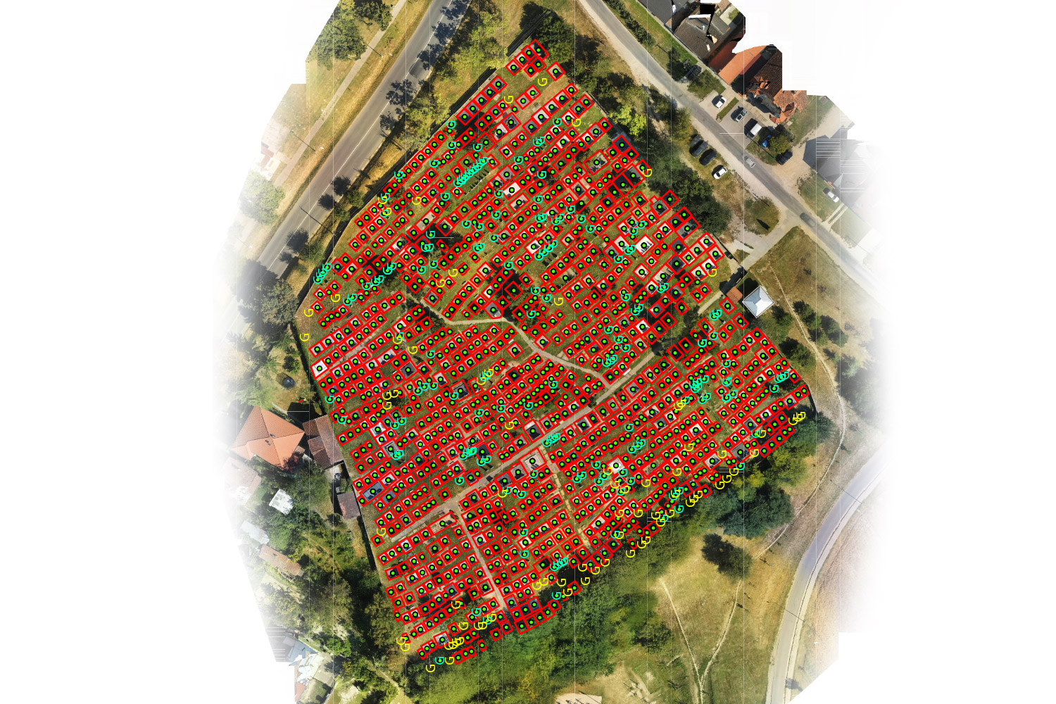
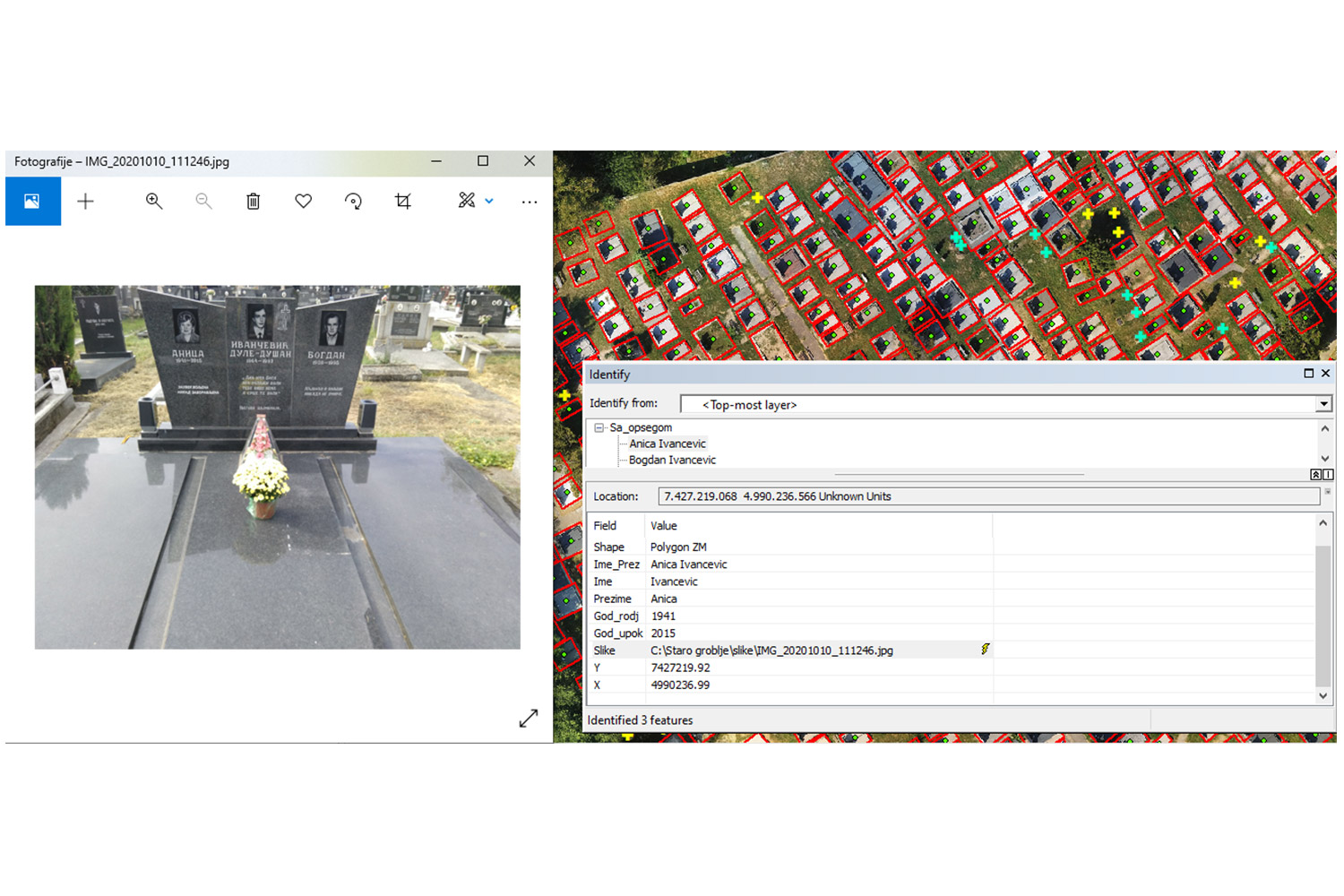
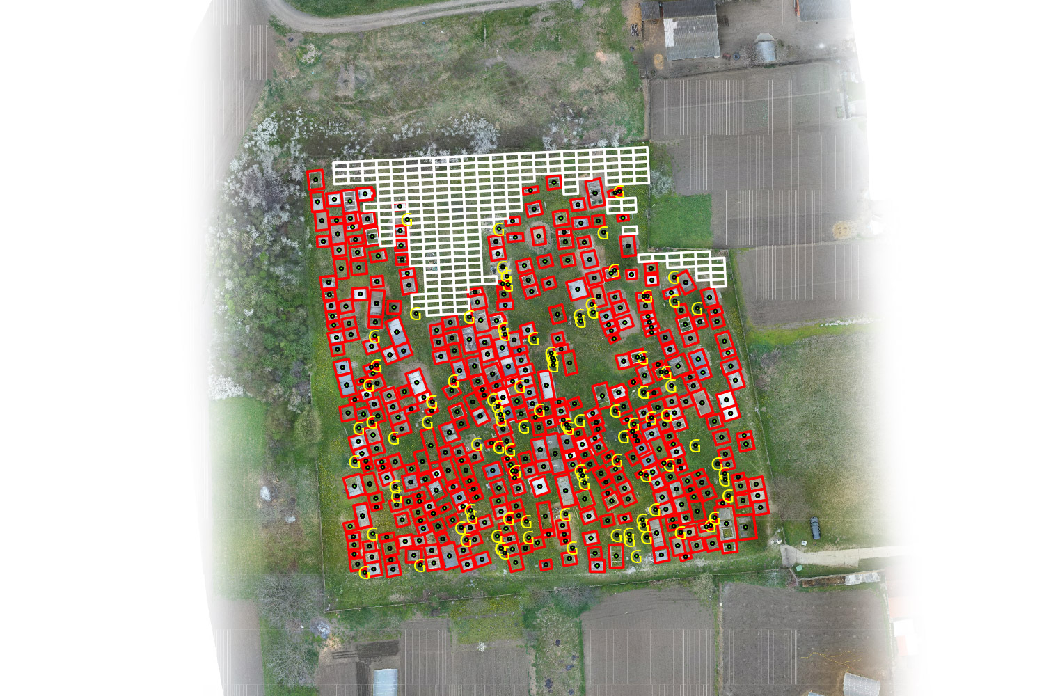
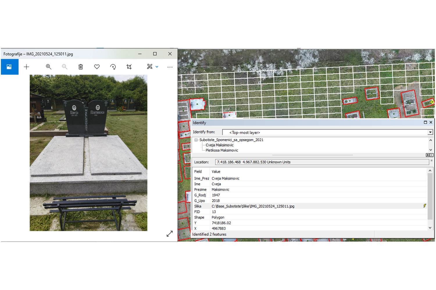
Geographic information systems enable digital representation of spatial entities and at the same time store data on their position, geometry, mutual spatial relations and numerous other thematic attributes that are not related to space. The data is stored in a searchable database by querying according to the desired criteria. The GIS system can be published on the web and made available to the general public. The application of GIS is numerous - construction, agriculture, forestry, ecology, mining, energy, management and protection against catastrophic events, urbanism, design and planning.
The most common works implemented in this area relate to the digitization of analog geospatial data, design and development of GIS applications, design and development of spatial databases and design and development of WEB GIS applications.
In order to carry out work in this area with satisfactory quality and accuracy, it is necessary to hire experienced experts who will perform a detailed analysis of available spatial and non-spatial data and, if necessary, collect additional data to form a purposeful geographic information system of adequately designed structure and content.